Jerusalem's Borders as Seen on Google Earth
Google Earth, the zoomable satellite photo program produced by Google, shows the Temple Mount in Jerusalem as not being in Israel, but being entirely as part of the West Bank (Palestinian Territories). In fact, a substantial portion of eastern Jerusalem is shown as not being part of Israel. This randomly placed straight line completely ignores the geo-political realities on the ground and contradicts every international border designation that has ever been agreed upon or even proposed.
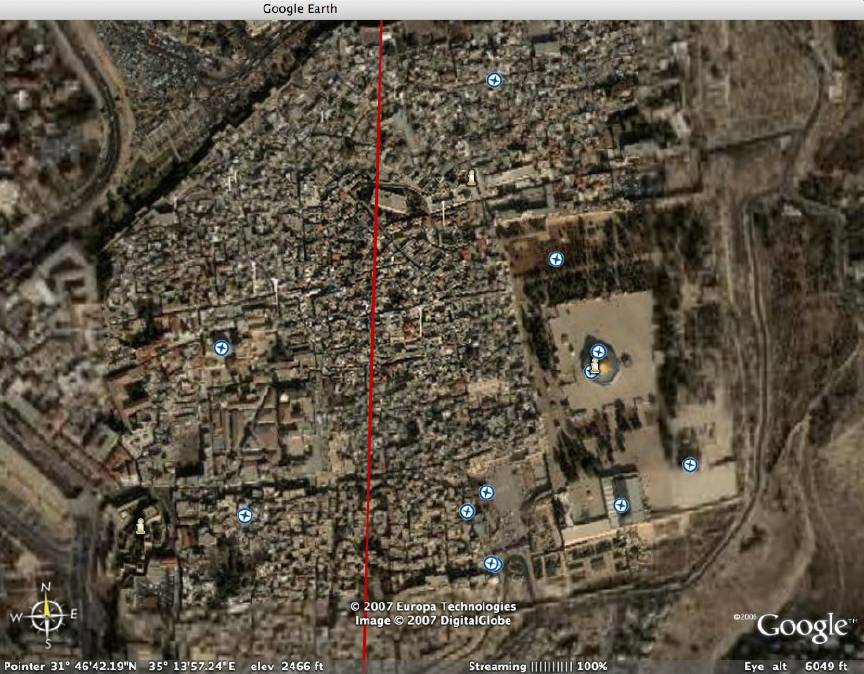
The red line in the picture is Google's version of the border between Israel (left side) and the West Bank (right side). The Temple Mount, containing the ancient Temple of Solomon, the Western Wall, and the al-Aqsa Mosque and the Dome of the Rock Mosque, is visible on the center-right, on the Palestinian side of the line.
This error was first pointed out in an article published in the newspaper Israel Insider.
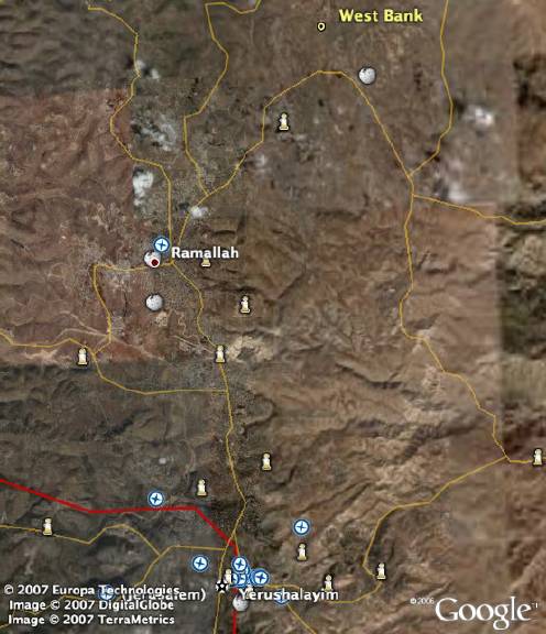
The overview is provided to show Google's version of the border from a greater distance.
As the screenshots above show, the maps used in Google Earth are not created by Google itself but instead are provided by a company called Europa Technologies. The anti-Israel map notations mentioned in the Israel Insider article are also not provided by Google, but are written by contributors in the general public. So, although Google itself did not create either the erroneous border lines nor the inaccurate comments, it does allow both of these anti-Israel biases to presented as factual in its supposedly trustworthy "Google Earth" program.
(Click here to return to the main zombietime page.)